Pioneering computer models have transformed global flood risk management
The same digital tools that protect global computer servers from flood damage promise to shed light on the social injustices of flooding under climate change.
Research highlights
- The LISFLOOD-FP flood inundation model developed by the University of Bristol's Hydrology Research Group has been adopted by over 1600 NGOs, multinational companies, governments, reinsurers and more.
- Spin-out company Fathom has created the first high-resolution simulations of continental and global flood dynamics, hazards and risks.
- Flood risk management and decision making have improved globally, resulting in avoided losses, reduced risks to populations and the creation of numerous jobs in the hazard risk analysis sector.
Fine-tuned global analytics
Professor Paul Bates and Dr Jeff Neal of the University of Bristol's Hydrology research group are responsible for the world's first high-resolution simulations of flooding.
Underpinning both the high-level detail and vast scale of these modelling tools are a powerful set of algorithms developed by the research group.
These algorithms allow for flood-risk assessments that are 10 to 100 times quicker than the methods they replaced.
The team's modelling tools typically map flood risk at resolutions of 30-90 meters. With the right underpinning data and over a small area of land, these tools have also mapped flood risk in megacities at a one-metre resolution.
In one UK case, mapping was done at just a 10-centimetre resolution.
Previously, flood-risk analyses tended to focus on relatively small areas and were largely confined to a handful of developed countries with the resources to gather data using on-the-ground techniques.
Bristol's flood-risk analytics can simulate flood-risk in high resolution at the continental or global scale - and for any region in the world.
Supporting communities, industry and NGOs
The need to understand flood risk has never been greater for so many sectors, especially as we confront the tough realities - and uncertainties - of climate change.
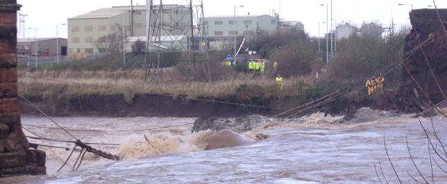
To date, the Bristol team have lent their flood-risk expertise to online tech companies, insurance firms, supply chain managers, financial authorities and many more. Notably, the research has helped humanitarian agencies prepare for disasters in a more targeted way.
When cyclones struck Mozambique in March 2019 and January 2021, flood-risk maps compiled by the University of Bristol and partners helped UK Government-funded humanitarians predict which areas would be hit the hardest and plan accordingly.
Social justice and climate change
In a new phase of their work, the Bristol research group questioning if flooding poses a higher risk to marginalised or disadvantaged communities. For example, is there a racial bias to flood risk?
Other scholars have demonstrated the disproportionate impacts of flooding on disadvantaged communities. This can be caused by a lack of green spaces in inner-city areas, or a propensity by developers to build housing for poorer communities and floodplains.
The Bristol group are further exploring the social distribution of flooding by fusing their flood-risk data with socio-economic data and future climate change projections.
Their work in this area so far has estimated a 30-127% increase in the number of people at risk from future floods in the US and emphasised the vulnerability of coastal communities in Bangladesh and India to sea-level rise and cyclones.
If you're using Microsoft Teams or OneDrive, or if you've got teenage kids on Xbox Live, all that is being routed through servers that are protected by our data.
Connect with the researchers
Professor Paul Bates, Professor of Hydrology, School of Geographical Sciences
Professor Jeff Neal, Professor of Hydrology, School of Geographical Sciences
Cite the research
Bates PD, Horritt MS and Fewtrell TJ (2010). A simple inertial formulation of the shallow water equations for efficient two dimensional flood inundation modelling, Journal of Hydrology, 387, pp.33-45
Sampson CC, Smith AM, Bates PD, Neal JC, Alfieri L and Freer JE (2015). A high resolution global flood hazard model, Water Resources Research, 51(9), pp.7358-7381
Neal J, Schumann GJ-P and Bates PD (2012). A subgrid channel model for simulating river hydraulics and floodplain inundation over large and data sparse areas, Water Resources Research, 48, Paper no. W11506